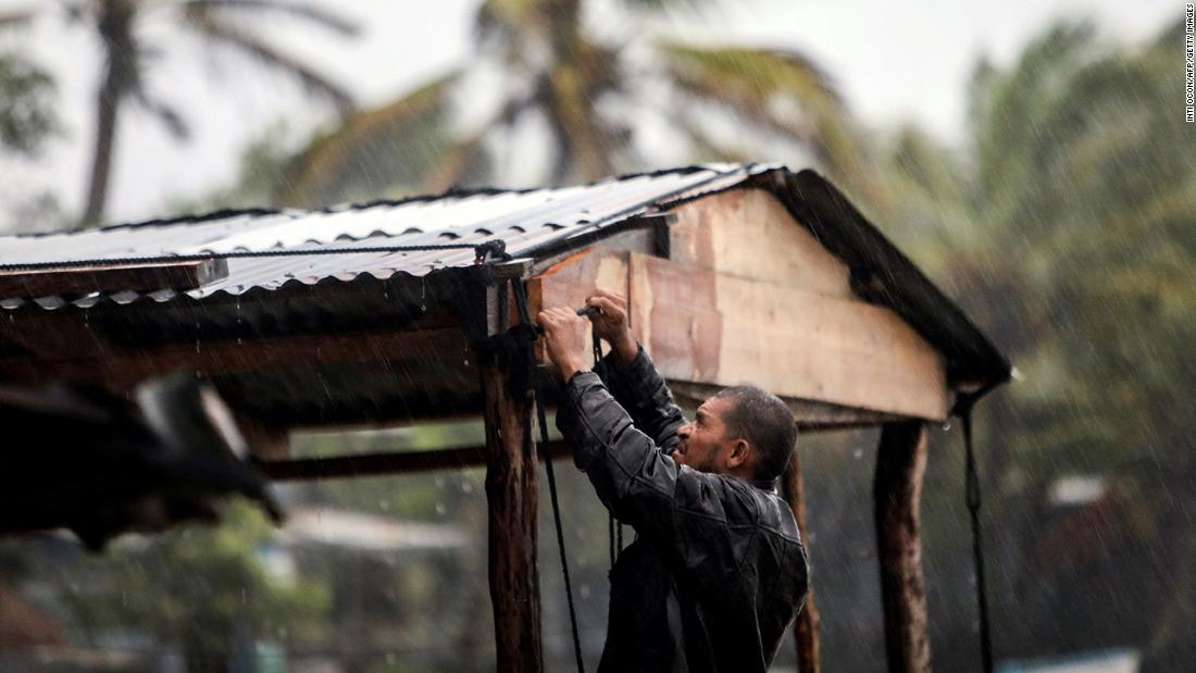
By 6 a.m. Tuesday (7 a.m. ET), the Category 4 storm -- with maximum sustained winds of 145 mph -- was centered in the Caribbean and inching toward Nicaragua's coast, about 30 miles southeast of Puerto Cabezas, the US National Hurricane Center said.
In Puerto Cabezas, a city in one of Nicaragua's poorest regions, a Catholic priest told Reuters on Monday that power already was out citywide and shelters set up by the government were at capacity.
"This city of 70,000 people is very vulnerable. We have houses made of wood and adobe, the infrastructure of the residential houses is our main vulnerability," the priest, Javier Plat, told Reuters.
A hurricane warning was in effect Tuesday for a roughly 150-mile stretch of Nicaraguan coastline, from the Honduras/Nicaragua border south to Sandy Bay Sirpi on east-central Nicaragua's Caribbean coast.
The storm could deliver life-threatening conditions in Nicaragua and other Central American nations for days, including nearly 3 feet of rain in isolated parts of Nicaragua and Honduras through Friday, the NHC said.
Heavy rain already was falling in eastern Nicaragua and Honduras on Tuesday morning, with the worst expected to come as the storm approaches the region's mountain ranges.
"This rainfall will lead to catastrophic, life-threatening flash flooding and river flooding, along with landslides in areas of higher terrain of Central America," the NHC said.
Dangerous storm surge of up to 21 feet above normal tide also could crash onshore in parts of Nicaragua, Central America's poorest nation, the NHC said.
The current forecast has the storm meandering the mountains of Nicaragua and Honduras before heading north toward Belize as a depression by Friday. The track and intensity of the storm remains uncertain after Friday and will be closely monitored.
The slow-moving and rapidly intensifying storm -- its sustained wind speed more than doubled over the Caribbean from Sunday evening to Monday evening -- is the latest in an active Atlantic hurricane season.
As the 28th named storm in the Atlantic this season, it ties the record for the number of named storms in a single season set back in 2005.
Conditions deteriorating along the coast
The storm has the potential to be one of the worst flooding events Nicaragua has seen since Hurricane Mitch in 1998, which killed more than 10,000 people.
The storm is expected to deliver "catastrophic wind damage" wherever the eyewall smacks land, the NHC said.
Torrential rain, and resulting flooding and landslides, are expected to be among the main threats. The wind and storm surge threat should diminish throughout Tuesday, but the rain will last well into the week.
Rain forecasts through Friday evening, according to the NHC:
• Much of Nicaragua and Honduras: Generally 15-25 inches, with isolated amounts up to 35 inches.
• Eastern Guatemala and Belize: Generally 10-20 inches, with isolated amounts up to 25 inches.
• Parts of Panama and Costa Rica: Generally 10-15 inches, with isolated amounts up to 25 inches.
• Jamaica and southeastern Mexico: Generally 5-10 inches, with isolated amounts up to 15 inches.
• El Salvador, southern Haiti, and the Cayman Islands: Generally 3-5 inches, with isolated amounts up to 10 inches.
World - Latest - Google News
November 03, 2020 at 08:47PM
https://ift.tt/326YTW6
Category 4 Hurricane Eta nears Nicaragua landfall and is poised to bring catastrophic damage - CNN
World - Latest - Google News
https://ift.tt/2SeTG7d
Bagikan Berita Ini


0 Response to "Category 4 Hurricane Eta nears Nicaragua landfall and is poised to bring catastrophic damage - CNN"
Post a Comment